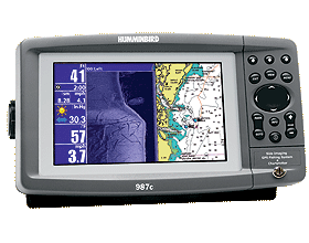
GPS
Chartplotting
The
GPS part of this package is feature packed. You can save upto
3000 waypoints, 50 routes, 50 tracks with 20 000 points in each
track. You have full track plotting available and the option of
3D highway view (also called Bird's Eye View) where you can look
at you postion from any angle, direction or height. This is a
great tool for looking around at land masses, way points etc,
You can even fly over the horizon, go as high at the Hubble Telescope
or down to sea level.
The 987 CX SI has a built in Uni-Map which shows the Australian
Coastline down to 4 nautical miles across the screen. There are
even some lakes shown on there as well. For greater detail, tide
info, navigation aids, spot soundings & depth contours along
the coastline you will need a Navionics Gold chart.
As
with almost all of the current ranges of Humminbird Combo units
(Matrix, 700 & 900 Series), the 987 isnt just one part GPS
& one part Sonar. These units hhave the capability to split
screen many of the most favoured screen. You can split between
the Side Imaging & GPS, 2D Sonar & Side Imaging etc and
adjust the width of the split to your liking. The Humminbird are
fully integrated and offer the ability to put a waypoint onto
the screen by moving a cursor to the place on the bottom of the
sonar or Side Imaging screen & then placing the waypoint.
This also logs the depth of the mark, not just the lat & long.
Optional
Extras
The 900 Series Humminbirds run on a windos based software package.
This allows for easy addition of hardware just like adding a new
mouse to your computer. Optional plug & Play features include
a WeatherSense barometric pressure Monitor, SmartCast interface
and GPS capability once an antennae is plugged in (for non-GPS
Plotter standard units).
PC
Software
And just like software on your computer, you can update the software
on your unit as udates become available. You only need an optional
cable from your Humminbird Dealer. All you need to do is go to
the Humminbird.com website and download the free software and
away you go.
Limitations
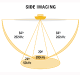
The only limitations we found on these units is the depth capability
of the Side Imaging which is a maximum of 25 meters / 75 feet.
The Side Imaging is not intended for use at speed or up on the
plane, however we had one giving us moderate returns at 45 km/hr.
The optimal spped for side imaging is around 12 knots max.
Best
Applications:
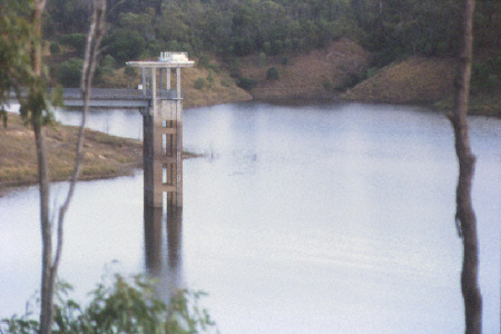
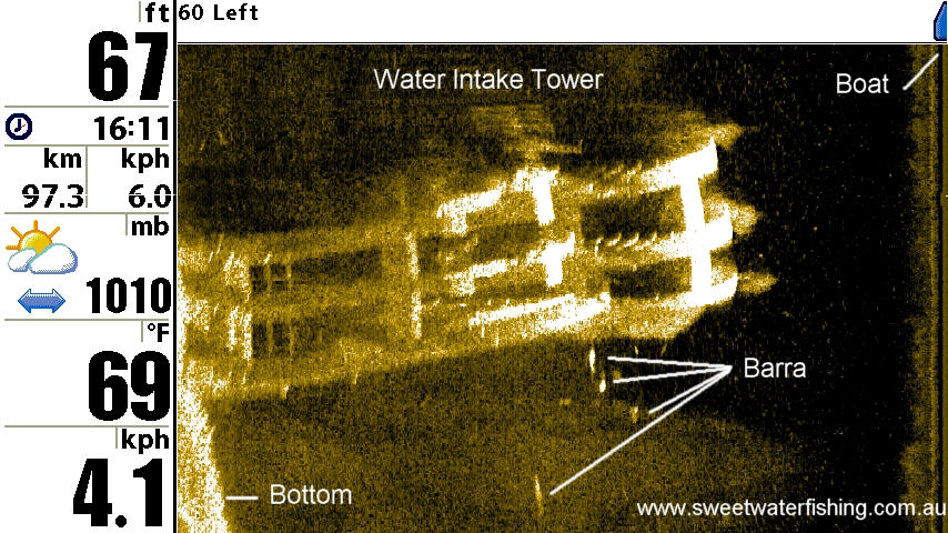
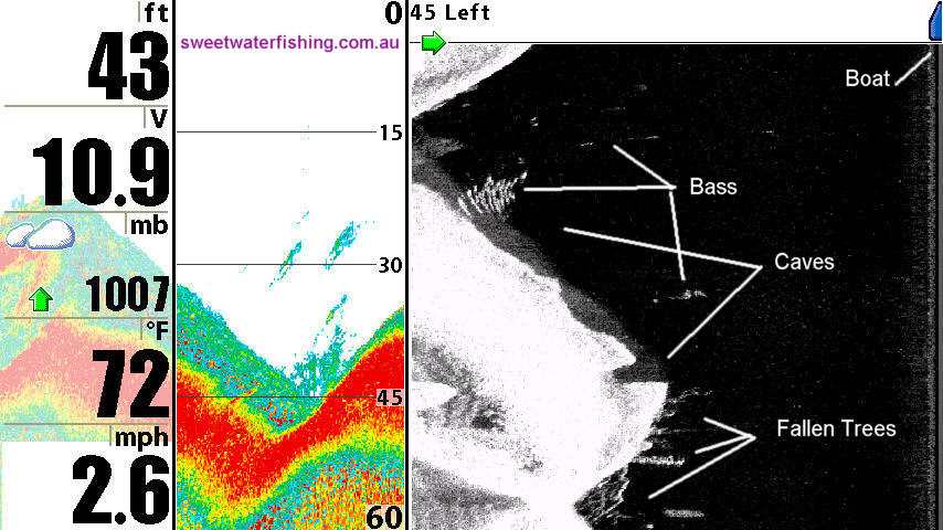
- These units are fantastic at for seeing under undercut backs,
docks, peirs and bridges to see what is lurking.
- Great for scanning for fish & structure in shallow water
without taking the boat there & spooking the fish.
- Offshore fishing for pelagic fish and bait. The ability to scan
240 feet either side simultaneously can show you where the fish
/ bait are even when the birds arent working or the fish are busting
up the surface.
- Reef fishing. Will show every nook & cranny where reef fish
can hide.
- I even saw a CSIRO researcher using a 900 Series unit to do
an Ultra-Sound on a cow with broken bones in its back. No Bull!!
(Pardon the pun)
Conclusion
The Humminbird 987 CX SI lives upto its claims of high resolution
images. It is very user friendly, fully servicable, packed
with features and the bonus of the upgradable & expandable
system will see these units retain their re-sale value for longer
than average. I wasnt happy when I had to give the loan unit back.
Retailing for just over $4000 the 987 CX SI is not toy, that for
sure. However I'm sure those that invest in one of these units
will be as blown away as I was when you see what they're capable
of.
Related
Links:
Humminbird
USA
Humminbird
Australia
Update:
2007
The Humminbird 987CXSI & 981CXSI have been replaced
by the Humminbird 997CXSI. This is a Sonar / GPS / Chart
Plotter/ Side Imaging combo.
The main differences are:
-
Larger
screen by 1 inch diagonally, now 9 inch diagonal.
-
Better
quality pixels, now fully daylight viewable
-
Will
take Navionics Gold OR Platinum
-
Higher
frequency on Side Imaging for even crisper on-screen
images
Humminbird
797CXSI
There is also now a Side Imaging unit available in the Humminbird
700 Series.
The Humminbird 797CXSI is a 787CX with Side Imaging included.
It is a basically a smaller version of the 997CXSI described
above.
|